Local context
Holbox's Ocean Is Not What You Expect
Anyone arriving in Holbox expecting the deep blue Caribbean gets an immediate surprise: the water here is green-turquoise, not the intense sapphire of Tulum or Cozumel. The reason is both geographic and biological. Holbox is not in the Caribbean — it sits in the Gulf of Mexico, where the continental shelf is extremely shallow. At 200 meters (650 feet) from shore, the water barely reaches 50 centimeters (20 inches) of depth. The fishing grounds farther out range from 1.5 to 3 meters (5 to 10 feet). That proximity of the sandy bottom to the surface, combined with abundant seagrass beds and organic particles drifting from the surrounding mangroves, gives the water its characteristic green tone that shifts to crystalline turquoise on calm, windless days.
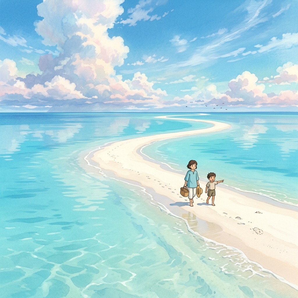
At Punta Mosquito, during low tide, you can literally walk across sandbanks with water at ankle height, pushing hundreds of meters toward the horizon. It is an experience that does not exist on any conventional Caribbean beach: an almost lunar landscape where the sea disappears and leaves shallow pools of water surrounded by white sand. The walk to Punta Mosquito itself is 4 to 5 kilometers (about 3 miles) from town — reachable by bicycle in 40 minutes along a sandy path, or by guided tour in a golf cart.
The town pier, meanwhile, sits over the Yalahau Lagoon estuary, not over the open sea. The water there is darker, with a mangrove scent and sediment, and has a completely different depth and composition from the north-facing beach. It is not dirty — it is estuarine water, rich in nutrients, where crabs, small jellyfish, and lagoon fish coexist. Understanding this distinction prevents the disappointment some visitors feel when they first see the pier and assume the whole island's water looks like that.
Playa Norte, the main beach strip facing the open Gulf, is exposed to what locals call the "marea del norte" (northern tide) when wind blows from that direction. During these episodes the water level rises, waves build, and the beach narrows noticeably. It is a phenomenon that surprises anyone who has only seen Holbox in perfectly calm Instagram photos.
Seasonality
Ocean Conditions by Season
January through March — Water temperature between 76°F and 78°F (24.6-25.4°C), the coolest of the year but perfectly swimmable without a wetsuit. Norte conditions (cold fronts from the north) can generate waves up to 4 meters (13 feet) and persist for 1 to 3 days, canceling all water tours and making swimming impossible. Between norte episodes, the sea returns to its characteristic calm with swells of barely 4 to 16 inches (0.1-0.4 meters). The key for winter visitors: check the forecast before booking any water activity, and have land-based backup plans ready.
April and May — Water climbs to 80-82°F (26.5-27.5°C) and calm conditions are nearly constant. These are the two ideal months for swimming, snorkeling, and stand-up paddleboarding without worrying about wind or surf. The dominant current (east to west, at 4-20 inches per second) is barely perceptible at beach level. If you want guaranteed flat water, this is your window.
June through September — The warmest season: water reaches 83-85°F (28.2-29.3°C), peaking in August at 85°F (29.3°C). The east-to-west current intensifies slightly. June records the year's minimum tide, which exposes more sandbanks at Punta Mosquito — a spectacular time for that walk. Afternoon rains can chop up the surface temporarily, but mornings are typically calm. This is also whale shark season, and the warm water concentrations of plankton that feed the whale sharks are the same nutrient dynamics that drive the entire Holbox marine ecosystem.
October and November — Water drops from 83°F to 80°F (28.4°C to 26.6°C) as the first nortes arrive. November records the year's maximum tide: 657 mm above mean lower low water (MLLW). The sea becomes unpredictable, with days of perfect calm interrupted by episodes of heavy surf. This is transition season — excellent when conditions cooperate, frustrating when they do not.
December — Temperature at 77°F (25.3°C) with frequent nortes. The sea gets rough during episodes and the beach can lose meters of sand to the elevated water level. Between nortes, days are spectacularly clear and the water regains its transparency. December visitors should plan for at least one or two days of disrupted water conditions during a week-long stay.
Water quality
Why the Water Is Green (And Why That Is a Good Thing)
The most common misconception about Holbox's ocean is that green water means pollution. It does not. The green tint comes from three entirely natural sources: phytoplankton (microscopic algae that form the base of the marine food chain), suspended organic particles transported from the surrounding mangrove ecosystem, and seagrass beds visible through the shallow water column. These are signs of a healthy, productive marine environment — the same nutrient-rich waters that attract whale sharks, support bioluminescence, and sustain the fishery that has fed Holbox families for generations.
On windless days, when sediment settles and the water column stabilizes, Holbox's ocean clears to a stunning turquoise transparency where you can see the sandy bottom with perfect clarity. The transformation between a windy, green-water day and a calm, turquoise day can happen overnight. Both states are natural and neither indicates contamination.
The deep blue water that travelers associate with "clean Caribbean" is actually a sign of oligotrophic (nutrient-poor) waters — beautiful to look at, but biologically sparse. Holbox's green-tinged water teems with life precisely because it is nutrient-rich. You are swimming in one of the most productive marine ecosystems in the Gulf of Mexico, not in a degraded environment.
Safety
Jellyfish, Currents, and Norte Conditions
Jellyfish: Present seasonally, particularly from June through September. Most species found at Holbox deliver mild stings comparable to a mosquito bite — uncomfortable but not dangerous. The small, transparent box jellyfish (Carybdea) occasionally appears and produces a more painful sting. Wearing a rash guard while swimming reduces exposed skin. Vinegar (available at most beach clubs) is the appropriate first treatment for stings — do not use fresh water, urine, or alcohol, which can activate undischarged nematocysts.
Currents: The dominant current runs east to west at 4 to 20 inches per second (10-50 cm/s). At beach level this is barely noticeable for swimmers. However, if you wade far from shore at Punta Mosquito during low tide and the tide turns, the returning water can catch you off guard in what felt like dry sand minutes before. Pay attention to tidal movement when walking the sandbars.
Norte conditions: Cold fronts arriving from the north between October and March generate the most dramatic sea state changes on Holbox. Waves can build to 4 meters (13 feet), wind speeds reach 40-60 km/h (25-37 mph), and the entire character of the beach changes within hours. All water-based tours cancel during nortes. Swimming becomes dangerous and is strongly discouraged. Nortes typically last 1 to 3 days, then conditions reset to calm. Local weather forecasts and your hotel can advise on timing.
Key reference data: depth of 20 inches (50 cm) up to 650 feet (200 m) from shore. Fishing zones at 5-10 feet (1.5-3 m) depth. Normal swell 4-16 inches (0.1-0.4 m). Dominant current east to west at 4-20 inches per second (10-50 cm/s).
Common myths
Myths vs. Reality
"The ocean at Holbox is the same as any Caribbean beach."
Holbox is in the Gulf of Mexico, not the Caribbean. The water is greener than blue, the current runs east to west (opposite to Caribbean currents), and there are no coral reefs. It is a completely different ecosystem from Tulum or Cozumel: sandy bottom, seagrass beds, and minimal depth rather than coral walls and deep water. Setting the right expectation before arrival prevents disappointment.
"The sea at Holbox is always perfectly calm."
Nortes, which occur from October through March, can generate waves up to 13 feet (4 meters). During these episodes, lasting 1 to 3 days, all water tours cancel and swimming becomes impossible. Social media photos always show the calm days, but Holbox's sea has an unpredictable character during the cold front season. Budget at least one disrupted day into any winter trip plan.
"The murky water at Holbox means pollution."
Turbidity at Holbox comes from three natural sources: seagrass resuspended by wave action, movement of the sandy bottom in extremely shallow water, and organic particles transported from the surrounding mangrove system. It is not pollution. On windless days, the water clears to crystalline transparency and you can see the bottom with perfect clarity. The green tint is a sign of ecological health, not degradation.
"You can scuba dive at Holbox like you can at Cozumel."
Beach depth at Holbox ranges from 1.5 to 6 feet (0.5 to 2 meters), making tank diving impossible. The mode of underwater exploration here is snorkeling. Tours to Cabo Catoche offer somewhat greater depth, but nothing comparable to Cozumel's 100-130 foot (30-40 meter) reef walls. Holbox is for floating, wading, and observing marine life from the surface — a fundamentally different experience from Caribbean reef diving.
Frequently asked questions
What people ask
Is it safe to swim in Holbox?
Extremely safe in normal conditions: 50 cm deep at 200m from shore, virtually no waves. Exception: Norte days with waves up to 4 meters.
When is the water warmest?
August at 29.3°C (84.7°F). June–October above 28°C (82°F). January–March is coolest (24.6–25.4°C / 76–78°F), still warm for most.
Why is the water green and not blue?
Holbox sits on the Gulf with shallow phytoplankton-rich waters. The low depth prevents the deep Caribbean refraction. It's not pollution.
Are there jellyfish?
They appear occasionally in summer. Operators warn when they're present. Carrying vinegar is a local precaution.
How far is Punta Mosquito from town?
4–5 km along the beach. On foot 60–70 minutes during low tide. Also accessible by bike, golf cart, or kayak.
Next step